Publications Image

Our Products

North America Map of stable Water Table Depth

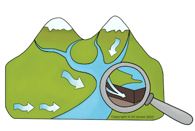
This product, a culmination of extensive research, includes three sets of machine learning-based simulations of static Water Table depth (WTD) at 500 m resolution in shallow unconfined aquifers across the USA and Canada. We utilized a vast dataset of more than 20 million real and proxy observations of WTD in developing these three products, ensuring the reliability and accuracy of our results. The three simulations were developed by gradually adding WTD proxy data to the real observation of WTD from Version 1 (V1) to Version 3 (V3). All three versions of the simulation leveraged machine learning algorithms constrained by physical relationships governing the spatial dynamics of WTD. Assessing the quality of the products against independent lines of evidence revealed that V2 provides the most accurate simulations along low-elevation landscapes near small to large permanent surface water bodies (e.g., Prairie Pothole Region), while V3 provides reasonable simulations in both low-elevation and high-elevation landscapes. The details of the methods, data compiling, and evaluation of the three products can be found in the below pre-print https://eartharxiv.org/repository/view/7067/

Publications Image
Card Image